Back Slough Afrikaans Slough AN سلاو (باركشير) Arabic سلاو ARZ Slough AST اسلاو، اینگیلیس AZB Слау Byelorussian Слау Bulgarian Slough Catalan Slough (kapital sa kondado) CEB
| Unitaire autoriteit in Engeland | |||
|---|---|---|---|
| Situering | |||
| Regio | South East England | ||
| Coördinaten | 51° 31' NB, 0° 36' WL | ||
| Algemeen | |||
| Oppervlakte | 32,5419[1] km² | ||
| Inwoners (2018[2]) |
149.112 (4582 inw./km²) | ||
| Overig | |||
| Postcode(s) | SL1-SL3 | ||
| Netnummer(s) | 01753 | ||
| Grid code | SU978797 | ||
| Post town | SLOUGH | ||
| Website | slough.gov.uk | ||
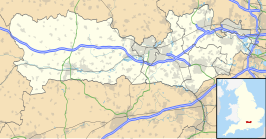
| Detailkaart | |||

| |||
| |||
Slough ([slaʊ]?) is plaats in Engeland; een city, een unitary authority en een district (ONS-code E06000039) in het ceremoniële graafschap Berkshire. Oorspronkelijke dorpen die thans buitenwijken vormen van het moderne Slough zijn: Britwell, Chalvey, Cippenham, Colnbrook, Ditton, Langley, Poyle, Upton, Wexham en grote delen van Burnham (Buckinghamshire).
- ↑ Office for National Statistics → Download → SAM_for_Administrative_Areas_(2018).zip → SAM_LAD_DEC_2018_UK.xlsx.
- ↑ https://www.ons.gov.uk/file?uri=/peoplepopulationandcommunity/populationandmigration/populationestimates/datasets/populationestimatesforukenglandandwalesscotlandandnorthernireland/mid20182019laboundaries/ukmidyearestimates20182019ladcodes.xls Schatting Office for National Statistics: knop MYE5 → kolom Estimated Population mid-2018]
