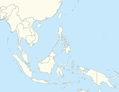
Back Geumpa bumoë Laôt Hindia thôn 2004 ACE Indiese Oseaan-aardbewing en -tsoenami van 2004 Afrikaans زلزال وتسونامي المحيط الهندي 2004 Arabic Terremotu del océanu Índicu de 2004 AST Hind okeanında zəlzələ və sunami (2004) Azerbaijani Һинд океанында ер тетрәүе (2004) Bashkir Землетрасенне ў Індыйскім акіяне ў 2004 годзе Byelorussian Землятрус у Індыйскім акіяне 2004 году BE-X-OLD Земетресение в Индийския океан (26 декември 2004) Bulgarian ২০০৪-এর ভারত মহাসাগরে ভূমিকম্প ও সুনামি Bengali/Bangla
 Village near the coast of Sumatra | |
| UTC time | 2004-12-26 00:58:53 |
|---|---|
| ISC event | 7453151 |
| USGS-ANSS | ComCat |
| Local date | 26 December 2004[1] |
| Local time | |
| Duration | 10 minutes |
| Magnitude | 9.1–9.3 Mw |
| Depth | 30 km (19 mi) |
| Epicenter | 3°18′58″N 95°51′14″E / 3.316°N 95.854°E |
| Fault | Sunda Megathrust |
| Type | Megathrust |
| Areas affected | Indian Ocean coastline areas |
| Total damage | US$15 billion[2] |
| Max. intensity | IX (Violent) |
| Tsunami | |
| Casualties | 227,898 dead[5][6][7] |

The 2004 Indian Ocean earthquake and tsunami, also called the Sumatra-Andaman earthquake (known by the scientific community), was a great underwater earthquake. It happened at 00:58:53 UTC (07:58:53 local time) December 26, 2004.
The epicenter of the earthquake was off the west coast of Sumatra, Indonesia. At first, the earthquake was measured as a 9.0 on the Richter scale. It was the longest ever recorded ocean earthquake. It lasted between 500 (8.3 minutes) and 600 (10 minutes) seconds. It was so powerful that it caused the entire Earth to vibrate. It started other earthquakes as far away as Iceland.
- ↑ "Magnitude 9.1 – Off the West Coast of Sumatra". U.S. Geological Survey. Archived from the original on 17 August 2012. Retrieved 26 August 2012.
- ↑ "Indian Ocean Tsunami – Economic Aspects". indianoceantsunami.web.unc.edu. Archived from the original on 2019-04-18. Retrieved 2019-04-18.
- ↑ "Astonishing Wave Heights Among the Findings of an International Tsunami Survey Team on Sumatra". U.S. Geological Survey. Archived from the original on 27 August 2016. Retrieved 16 June 2016.
- ↑ Paris, Raphaël; Cachão, Mário; Fournier, Jérôme; Voldoire, Olivier (1 April 2010). "Nannoliths abundance and distribution in tsunami deposits: example from the December 26, 2004 tsunami in Lhok Nga (northwest Sumatra, Indonesia)". Géomorphologie : Relief, Processus, Environnement. 16 (1): 109–118. doi:10.4000/geomorphologie.7865.
- ↑ "Joint evaluation of the international response to the Indian Ocean tsunami: Synthesis Report" (PDF). TEC. July 2006. Archived from the original (PDF) on 2006-08-25. Retrieved 9 July 2018.
- ↑ "Earthquakes with 50,000 or More Deaths". U.S. Geological Survey. Archived from the original on 5 June 2013.
- ↑ "Indian Ocean tsunami anniversary: Memorial events held". BBC News. 26 December 2014. Retrieved 15 December 2016.


