Back مطار البانى الدولى ARZ Albany County Airport CEB Albany International Airport German Albany International Airport English Aeropuerto Internacional de Albany Spanish فرودگاه بینالمللی آلبانی Persian Aéroport international d'Albany French オールバニ国際空港 Japanese 올버니 국제공항 Korean आल्बनी आंतरराष्ट्रीय विमानतळ Marathi
Albany International Airport | |||||||||||||||
|---|---|---|---|---|---|---|---|---|---|---|---|---|---|---|---|
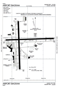
 FAA airport diagram | |||||||||||||||
| Summary | |||||||||||||||
| Airport type | Public | ||||||||||||||
| Owner | Albany County, New York | ||||||||||||||
| Operator | Albany County Airport Authority | ||||||||||||||
| Serves | Albany and Capital District, New York | ||||||||||||||
| Location | Latham, New York, U.S. | ||||||||||||||
| Focus city for | Cape Air | ||||||||||||||
| Elevation AMSL | 285 ft / 87 m | ||||||||||||||
| Coordinates | 42°44′57″N 073°48′07″W / 42.74917°N 73.80194°W | ||||||||||||||
| Website | www.albanyairport.com | ||||||||||||||
| Map | |||||||||||||||
| Runways | |||||||||||||||
| |||||||||||||||
| Statistics | |||||||||||||||
| |||||||||||||||
Albany International Airport (IATA: ALB, ICAO: KALB, FAA LID: ALB) is a public use airport six nautical miles (11 km) northwest of the central business district of Albany, in Albany County, New York, United States. It is owned by the Albany County Airport Authority.[1] It is an airport of entry[3] serving Albany. It is in the town of Colonie. It was built on the site of the Shaker settlement about 6 miles (10 km) north of Albany and stretching north to the hamlet of Verdoy. The airport is the seat of a class C airspace.[4]
- ↑ 1.0 1.1 FAA Airport Master Record for ALB (Form 5010 PDF). Federal Aviation Administration. effective January 5, 2017.
- ↑ 2010 North American Final Rankings, Airports Council International – North America, archived from the original on May 15, 2011[not in the source given]
- ↑ "Customs at ALB". Albany International Airport. Archived from the original on 2008-08-31. Retrieved 2008-08-12.
- ↑ "Albany Airspace". SkyVector.com. Archived from the original on 4 April 2009. Retrieved 2009-04-04.

