Back Barquna (dairə, Banqladeş) Azerbaijani বরগুনা জেলা Bengali/Bangla বরগুনা জিলা BPY Barguna CEB Barguna (Distrikt) German Barguna District English Barguna (zila) Spanish ناحیه برگونه Persian Barguna (district) French बरगुना जिला Hindi
Barguna
বরগুনা | |
|---|---|
| Barguna District | |
|
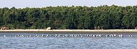
From top: Seabirds in Barguna Coastal area (Laldia beach), Tengragiri Wildlife Sanctuary, Bibicini Shahi Mosque, Haringhata Reserved Forest, Ashar Chor and Bibicini Shahi Mosque | |
 Location of Barguna in Bangladesh | |
 Expandable map of Barguna District | |
| Coordinates: 22°09′03″N 90°07′35″E / 22.1508°N 90.1264°E | |
| Country | |
| Division | Barisal Division |
| Government | |
| • Deputy Commissioner | Mustain Billah |
| • District Council Chairman | Md. Delwar Hossein [1] |
| • Chief Executive Officer | Md. Owahedur Rahman |
| Area | |
| • Total | 1,939.39 km2 (748.80 sq mi) |
| Population (2011 census) | |
| • Total | 892,781 |
| • Density | 460/km2 (1,200/sq mi) |
| Literacy rate | |
| • Total | 62.10% |
| Time zone | UTC+06:00 (BST) |
| HDI (2018) | 0.586[2] medium · 16th of 21 |
Barguna is a district in South-western Bangladesh. It is a part of the Barisal Division. It has a total area of 1831.31 km². It is bordered on the north by the districts of Jhalokati, Barisal, Pirojpur and Patuakhali. In the east, it borders Patuakhali District. On the south, Barguna is bounded by Patuakhali District, the Bay of Bengal. On the western side, it borders Pirojpur and Bagerhat districts. Important rivers of Barguna district include the Payra river, Bishkhali river and the Baleshwar river.
- ↑ zp.barguna.gov.bd
- ↑ "Sub-national HDI - Area Database - Global Data Lab". hdi.globaldatalab.org. Retrieved 2020-03-18.


