Back مقاطعة فيرفيلد (كونيتيكت) Arabic فيرفيلد كاونتى (كونيتيكت) ARZ Condáu de Fairfield (Connecticut) AST Fairfield County, Connecticut BAR Феърфийлд (окръг, Кънектикът) Bulgarian ফেয়ারফিল্ড কাউন্টি, কানেকটিকাট BPY Fairfield Gông (Connecticut) CDO Fairfield County (kondado sa Tinipong Bansa, Connecticut) CEB Fairfield County (Connecticut) Czech Fairfield County, Connecticut Welsh
Fairfield County | |
|---|---|
 Downtown Stamford | |
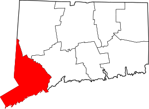
 Location within the U.S. state of Connecticut | |
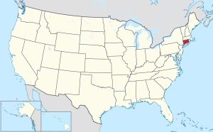
 Connecticut's location within the U.S. | |
| Coordinates: 41°14′N 73°22′W / 41.23°N 73.37°W | |
| Country | |
| State | |
| Founded | 1666 |
| Seat | none; since 1960 Connecticut counties no longer have a county government Fairfield (1666–1853) Bridgeport (1853–1960) |
| Largest municipality | Bridgeport (population) Newtown (area) |
| Area | |
| • Total | 837 sq mi (2,170 km2) |
| • Land | 625 sq mi (1,620 km2) |
| • Water | 212 sq mi (550 km2) |
| Population | |
| • Total | 957,419 |
| • Density | 1,532/sq mi (592/km2) |
Fairfield County is located in the southwestern corner of the U.S. State of Connecticut. As of the 2020 census, the county's population was 957,419.[1] The county has a total area of 2,168 km² (837 mi²). 1,621 km² (626 mi²) of it is land and 547 km² (211 mi²) of it is water. The total area is 25.23% water.
- ↑ 1.0 1.1 "Census - Geography Profile: Fairfield County, Connecticut". United States Census Bureau. Retrieved November 20, 2021.