Back Galuë Gaza ACE Gasastrook Afrikaans Gazastreifen ALS የጋዛ ስላጤ Amharic Francha de Gaza AN Gasaþwang ANG قطاع غزة Arabic قطاع غزة ARY قطاع غزه ARZ Franxa de Gaza AST
Gaza غَزَّة | |
|---|---|
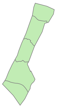
 Location of Gaza within Palestine | |
| Status |
|
| Capital and largest city | Gaza City 31°30′53″N 34°27′15″E / 31.51472°N 34.45417°E |
| Official languages | Arabic |
| Ethnic groups | Palestinian |
| Religion |
|
| Demonym(s) | Palestinian |
| Government | |
| Area | |
• Total | 365 km2 (141 sq mi) |
| Population | |
• 2022 estimate | 2,375,259[2] |
• Density | 6,507/km2 (16,853.1/sq mi) |
| Currency | Israeli new shekel Egyptian pound[3] |
| Calling code | +970 |
| ISO 3166 code | PS |

Gaza is a polity along the eastern coast of the Mediterranean Sea. The main city in Gaza is called Gaza City. The area is part of Palestine. Formally, the Palestinian National Authority governed it. Before 2007, Harakat At-Tahriri Al-Filistiniya administrated the territory. The area is geographically separated from the rest of Palestine.
- ↑ "Mideast accord: the overview; Rabin and Arafat sign accord ending Israel's 27-year hold on Jericho and the Gaza Strip" Archived 9 December 2020 at the Wayback Machine. Chris Hedges, New York Times, 5 May 1994.
- ↑ "مليونان و375 ألف نسمة عدد سكان قطاع غزة مع نهاية 2022". arabic.news.cn. Archived from the original on 5 January 2023. Retrieved 5 January 2023.
- ↑ Chami, Ralph; Espinoza, Raphael André; Montiel, Peter J. Macroeconomic policy in fragile states. Oxford: Oxford university press. ISBN 978-0-19-885309-1.
