Back Muur van Hadrianus Afrikaans Muro d'Hadrián AN سور هادريان Arabic سور هادريان ARZ Muriu d'Adrianu AST Adrian divarı Azerbaijani Hadrianswall BAR Вал Адрыяна Byelorussian Адрианов вал Bulgarian Moger Hadrian Breton


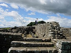
Hadrian's Wall (Latin: Vallum Aelium or Vallum Hadriani) is a stone and turf fortification built across northern Great Britain by the Roman Empire in the early second century. The Roman emperor Hadrian built the wall to control barbarians: the ancient Britons to the north of the wall. The wall is now in England, and runs between the Solway Firth and the River Tyne in northern England. When the Romans built the wall, it was the northern border of the Roman Empire.
The Roman legions (armies) of the governor of Roman Britain, Platorius Nepos, built the wall for the emperor between 122 and 126.[1] The wall was about 118 kilometres (73 miles) long.[1] Most of the wall – 67 kilometres (42 miles) – was made of stone. To the west of this section – for 46 kilometres (29 miles) – the wall was made of turf. The stone part of the wall was 3 metres (9.8 feet) thick and about 4.2 metres (14 feet) tall. The wall's turf part was 6 metres (20 feet) thick and about 4.2 metres (14 feet) tall.[1] To start with, the wall's east end was at Newcastle upon Tyne (Latin: Pons Aelius), but later the Romans built more stone wall for 6 kilometres (3.7 miles) to the east, to Wallsend on Tyne.[1] In front of the wall (on the northern side) was a ditch. The ditch was 6 metres (20 feet) away from the wall. The ditch was at about 3 metres (9.8 feet) deep and was normally about 8.2 metres (27 feet) wide.[1] The Romans used the wall for at least two hundred years.[1]
Hadrian's Wall is part of the UNESCO World Heritage Site called Frontiers of the Roman Empire.[2] It was made a UNESCO World Heritage Site in 1987.[3] It shares this listing with the Antonine Wall in Scotland and the German fortifications known as the Limes Germanicus. Hadrian's Wall was the first of two "great walls" created by the Romans in Great Britain. Its ruins are more visible than the lesser known Antonine Wall to the north.It also had small watch towers/fortes along it.
The Vallum is a huge earthwork associated with Hadrian's Wall. It runs from coast to coast to the south of the wall.
- ↑ 1.0 1.1 1.2 1.3 1.4 1.5 Richmond, Ian Archibald; Frere, Sheppard S.; Millett, Martin (2016). "wall of Hadrian". Oxford Research Encyclopedia of Classics. doi:10.1093/acrefore/9780199381135.013.6872. ISBN 978-0-19-938113-5. Retrieved 2021-04-18.
- ↑ Centre, UNESCO World Heritage. "Frontiers of the Roman Empire". UNESCO World Heritage Centre. Retrieved 2021-04-18.
- ↑ UNESCO, "Frontiers of the Roman Empire"; retrieved 2012-4-19.