Back إنديبيندنس Arabic انديبيندنس ARZ ایندپندنس، کانزاس AZB Independence (Kansas) Catalan Индепенденс (Канзас) CE Independence (kapital sa kondado sa Tinipong Bansa, Kansas) CEB Independence (Kansas) Danish Independence DAG Independence, Kansas English Independence (Kansas) Spanish
Independence, Kansas | |
|---|---|
City and County seat | |
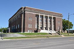
 Memorial Hall (2017) | |
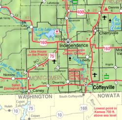
 Location within Montgomery County and Kansas | |
 | |
| Coordinates: 37°13′32″N 95°43′10″W / 37.22556°N 95.71944°W[1] | |
| Country | United States |
| State | Kansas |
| County | Montgomery |
| Founded | 1869 (Colfax) |
| Incorporated | 1870 |
| Named for | United States Declaration of Independence |
| Government | |
| • Type | Commission/City Manager |
| Area | |
| • Total | 7.67 sq mi (19.88 km2) |
| • Land | 7.67 sq mi (19.86 km2) |
| • Water | 0.01 sq mi (0.01 km2) |
| Elevation | 778 ft (237 m) |
| Population | |
| • Total | 8,548 |
| • Density | 1,100/sq mi (430/km2) |
| Time zone | UTC−6 (CST) |
| • Summer (DST) | UTC−5 (CDT) |
| ZIP Code | 67301 |
| Area code | 620 |
| FIPS code | 20-33875 |
| GNIS ID | 485598[1] |
| Website | independenceks.gov |
Independence is a city in and the county seat of Montgomery County, Kansas, United States.[4] In 2020, the 8,548 people lived there.[3] It was named after the Declaration of Independence.[5]
- ↑ 1.0 1.1 1.2 U.S. Geological Survey Geographic Names Information System: Independence, Kansas
- ↑ Cite error: The named reference
CenPopGazetteer2020was used but no text was provided for refs named (see the help page). - ↑ 3.0 3.1 "QuickFacts: Independence city, Kansas". United States Census Bureau. Retrieved November 30, 2023.
- ↑ "Find a County". National Association of Counties. Archived from the original on May 31, 2011. Retrieved 2011-06-07.
- ↑ Gannett, Henry (1905). The Origin of Certain Place Names in the United States. Govt. Print. Off. p. 165.