Back Cǣnsasburg (Cǣnsas) ANG كانساس سيتي (كنساس) Arabic كانساس سيتى, كانساس ARZ Kansas City (Kansas) AST کانزاس سیتی، کانزاس AZB Канзас-Сіці (Канзас) Byelorussian Канзас Сити (Канзас) Bulgarian ক্যানসাস সিটি, ক্যানসাস Bengali/Bangla Kansas City (Kansas) Breton Kansas City (Kansas) Catalan
Kansas City, Kansas | |
|---|---|
City and county seat | |
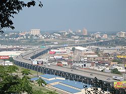
 Cityscape of Kansas City, Kansas | |
| Nickname: "KCK" | |
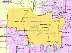
 Location within Wyandotte County and Kansas | |
 Kansas City map | |
| Coordinates: 39°6′24″N 94°40′35″W / 39.10667°N 94.67639°W[1] | |
| Country | United States |
| State | Kansas |
| County | Wyandotte |
| Incorporated | 1872, 1886 |
| Named for | Kansas City, Missouri |
| Government | |
| • Mayor | Tyrone Garner (D) |
| Area | |
| • Total | 128.30 sq mi (332.31 km2) |
| • Land | 124.74 sq mi (323.07 km2) |
| • Water | 3.57 sq mi (9.24 km2) |
| Elevation | 869 ft (265 m) |
| Population | |
| • Total | 156,607 |
| • Density | 1,200/sq mi (470/km2) |
| Time zone | UTC-6 (CST) |
| • Summer (DST) | UTC-5 (CDT) |
| ZIP codes | 66101-66113, 66115, 66117-66119, 66160 |
| Area code | 913 |
| FIPS code | 20-36000[1] |
| GNIS ID | 478635[1] |
| Website | wycokck.org |
Kansas City is the third-largest city in the U.S. state of Kansas. It is the county seat of Wyandotte County. Kansas City is a suburb of Kansas City, Missouri and is the third largest city in the Kansas City Metropolitan Area. About two million people live in this region. The city is part of the "Unified Government".[5] This also includes the cities of Bonner Springs and Edwardsville. As of the 2020 census, the city population was 156,607.[4] The city is at Kaw Point, which is the junction of the Missouri and Kansas rivers.
- ↑ 1.0 1.1 1.2 1.3 "Kansas City, Kansas". Geographic Names Information System. United States Geological Survey.
- ↑ Cite error: The named reference
CenPopGazetteer2020was used but no text was provided for refs named (see the help page). - ↑ Cite error: The named reference
DP1was used but no text was provided for refs named (see the help page). - ↑ 4.0 4.1 "QuickFacts: Kansas City city, Kansas". United States Census Bureau. Retrieved December 13, 2023.
- ↑ "Home - Unified Government". www.wycokck.org.
