Back Kingston upon Hull AN Cyngestūn on Hul ANG كينغستون أبون هال Arabic كينجستون ابون هال ARZ Kingston upon Hull AST Kinqston-apon-Hall Azerbaijani کینقستون آپون هال AZB Кінгстан-апан-Хал Byelorussian Кінгстан-апон-Гал BE-X-OLD Кингстън ъпон Хъл Bulgarian
Kingston upon Hull
Hull | |
|---|---|
Top: Hull City Hall, Hull College and Wilberforce Monument Middle: Hull Marina, Queen's Gardens and Maritime Museum Bottom: The Deep and Hull Minster | |
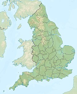
 Shown within the East Riding of Yorkshire | |
| Coordinates: 53°44′40″N 00°19′57″W / 53.74444°N 0.33250°W | |
| Sovereign state | United Kingdom |
| Country | England |
| Region | Yorkshire and the Humber |
| Ceremonial county | East Riding of Yorkshire |
| Founded | 12th century |
| City status | 1897 |
| Administrative headquarters | • Guildhall |
| Government | |
| • Type | Unitary authority |
| • Body | Hull City Council |
| • Leadership | Leader and cabinet |
| • Executive | Labour |
| • Lord Mayor | Lynn Petrini (L) |
| • Council Leader | Daren Hale (L) |
| • Chief Executive | Matt Jukes |
| Area | |
| • Land | 27.59 sq mi (71.5 km2) |
| Population (2005 est.) | |
| • City | 260,200 (Ranked 58th) |
| • Rank | (Ranked 58th) |
| • Density | 9,030/sq mi (3,486/km2) |
| • Urban | 314,018 |
| • Metro | 573,300 (LUZ) |
| • Ethnicity (2011 Census)[1] | 89.7% White British 0.3% White Irish 4.1% Other White 1.1% S. Asian 1.2% Black 1.3% Mixed Race 2.3% Chinese and other (0.8% Chinese) |
| Demonym | Hullensian |
| Time zone | UTC+0 (Greenwich Mean Time) |
| • Summer (DST) | UTC+1 (British Summer Time) |
| Postcode Area | |
| Dialling codes | 01482 |
| ISO 3166-2 | GB-KHL |
| ONS code | 00FA (ONS) E06000010 (GSS) |
| NUTS 3 | UKE11 |
| Primary airport | Humberside Airport (Outside of Kingston upon Hull) |
| Councillors | 57 |
| MPs | List of MPs |
| Website | hull.gov.uk |
Kingston upon Hull is usually called just Hull. It is an English city.
It is the "unitary authority" for the region of Yorkshire and the Humber. The region is in the Ceremonial county of the East Riding of Yorkshire.[2]
The city is on the North side of the River Hull where it meets the Humber Estuary (see diagram), 25 miles (40 km) from the North Sea.[2]
Hull has been a market town,[3] military supply port,[4] trading centre,[5] fishing and whaling port,[4] and industrial giant.[4] Hull was also an early battleground in the English Civil Wars,[5] and was the backdrop to events leading to the abolition of the slave trade in Britain.[6] Hull was heavily damaged during the Second World War,[5] and after a period of decline, when many factories closed;[7] the city has started to regenerate.[8] The Port of Hull is one of the UK's largest goods and passenger ports.
- ↑ UK Census (2011). "Local Area Report – Kingston upon Hull, City of Local Authority (1946157109)". Nomis. Office for National Statistics. Retrieved 1 March 2018.
- ↑ 2.0 2.1 "Kingston upon Hull". Encyclopædia Britannica Online. Encyclopædia Britannica. 2007. Retrieved 2007-09-29.
- ↑ "Brief history of Hedon". Hedon Town Council: Working for You. Hedon Town Council. 2007. Archived from the original on 2007-10-14. Retrieved 2007-09-22.
- ↑ 4.0 4.1 4.2 Cite error: The named reference
hcc_history_of_hullwas used but no text was provided for refs named (see the help page). - ↑ 5.0 5.1 5.2 Cite error: The named reference
shop_in_hullwas used but no text was provided for refs named (see the help page). - ↑ "Slavery: unfinished business". Wilberforce 2007: Hull. Wilberforce 2007: Hull. 2007. Archived from the original on 2007-09-21. Retrieved 2007-09-23.
- ↑ Parkinson, Michael (March 2006). State of the English Cities: Volume 1 (PDF). Champion, Tony; Evans, Richard; Simmie, James; Turok, Ivan; Crookston, Martin; Katz, Bruce; Park, Alison; Berube, Alan; Coombes, Mike; Dorling, Danny; Glass, Norman; Hutchins, Mary; Kearns, Ade; Martin, Ron; Wood, Peter. London: Office of the Deputy Prime Minister. p. 112. ISBN 978-1-85112-845-7. Retrieved 2007-07-01.[permanent dead link]
- ↑ "City Centre". Hull Citybuild. Hull Citybuild. 2007. Archived from the original on 2016-03-04. Retrieved 2007-09-23.


