Back مقاطعة مونتغومري (ماريلاند) Arabic Montqomeri qraflığı (Merilend) Azerbaijani Montgomery County, Maryland BAR Монтгомъри (окръг, Мериленд) Bulgarian মন্টগোমেরী কাউন্টি, মেরিল্যান্ড BPY Comtat de Montgomery (Maryland) Catalan Montgomery Gông (Maryland) CDO Монтгомери (гуо, Мэриленд) CE Montgomery County (kondado sa Tinipong Bansa, Maryland) CEB Montgomery County, Maryland Welsh
Montgomery County, Maryland | |
|---|---|
|
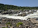
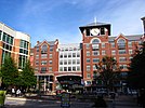
Clockwise: Downtown Bethesda, Spring Street in Silver Spring, Billy Goat B Trail, rural Darnestown, Rockville town center, Great Falls on the Potomac River. | |
| Nickname: "MoCo" | |
| Motto: French: Gardez Bien (English: Watch Well) | |
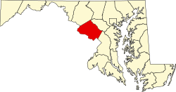
 Location in the U.S. state of Maryland | |
| Coordinates: 39°08′11″N 77°12′15″W / 39.13638°N 77.20424°W[1] | |
| Country | United States |
| State | Maryland |
| Seat | Rockville |
| Largest community | Germantown |
| Founded | September 6, 1776[2][3] |
| Named for | Richard Montgomery |
| Government | |
| • Executive | Marc Elrich (D) |
| Area | |
| • Total | 506.91 sq mi (1,312.89 km2) |
| • Land | 493.11 sq mi (1,277.15 km2) |
| • Water | 13.80 sq mi (35.74 km2) |
| Population (2020) | |
| • Total | 1,062,061 |
| • Density | 2,153.80/sq mi (831.59/km2) |
| Demonyms | Montgomery Countyan, MoCoite |
| Gross Domestic Product | |
| • Total | US$93.746 billion (2022) |
| Time zone | UTC−05:00 (Eastern [EST]) |
| • Summer (DST) | UTC−04:00 (EDT) |
| ZIP Codes | 20812–20918 |
| Area codes | |
| Congressional districts | 4th, 6th, 8th |
| Website | www |
Montgomery County of the U.S. state of Maryland is north of Washington, D.C. and southwest of Baltimore. It is one of the richest counties in the United States,[5] and has one of the highest percentages (32.8%) of residents over 25 years old who hold a post-graduate degree.[6] The county seat and largest municipality is Rockville.[7]
- ↑ "Montgomery County". GeoNames.org. Retrieved December 5, 2019.
- ↑ "Montgomery County Centennial: An Old-Fashioned Maryland Reunion". The Baltimore Sun. September 7, 1876. p. 1. ProQuest 534282014.
- ↑ Maryland. Convention (1836). Proceedings of the Conventions of the providence of Maryland, held at the city of Annapolis, in 1774, 1775, & 1776. Baltimore, Md.; Annapolis, Md.: Baltimore, James Lucas & E. K. Deaver; Annapolis, Jonas Green. p. 242. hdl:loc.gdc/scd0001.00117695347. LCCN 10012042. OCLC 3425542. OL 7018977M.
Resolved, That after the first day of October next, such part of the said county of Frederick as is contained within the bounds and limits following, to wit : beginning at the east side of the mouth of Rock creek on Potowmac river, and running with the said river to the mouth of Monocacy, then with a straight line to Par's spring, from thence with the lines of the county to the beginning, shall be and is hereby erected into a new county by the name of Montgomery county.
- ↑ "Gross Domestic Product by County and Metropolitan Area, 2022" (PDF). www.bea.gov. Bureau of Economic Analysis.
- ↑ https://www.washingtonpost.com/wp-dyn/content/article/2006/08/29/AR2006082901543.html
- ↑ "What Counties in the U.S. Are the Most Educated?". January 25, 2024. Retrieved May 6, 2024.
- ↑ "Maryland by Place - GCT-PH1-R. Population, Housing Units, Area, and Density (Geographies ranked by total population): 2000". Archived from the original on 2009-02-26. Retrieved 2009-01-02.


