Back Noord-Holland Afrikaans Holanda Septentrional AN شمال-هولندا Arabic هولاندا الشماليه ARZ Holanda Septentrional AST Şimali Hollandiya Azerbaijani Holland Kalér BAN Паўночная Галандыя Byelorussian Паўночная Галяндыя BE-X-OLD Северна Холандия Bulgarian
North Holland
Noord-Holland | |
|---|---|
Province | |
 | |
 Location | |
 Map | |
| Coordinates: 52°40′N 4°50′E / 52.667°N 4.833°E | |
| Country | Netherlands |
| Established | 1840 |
| Seat | Haarlem |
| Area | |
| • Total | 4,092 km2 (1,580 sq mi) |
| • Land | 2,663 km2 (1,028 sq mi) |
| • Water | 1,429 km2 (552 sq mi) |
| Highest elevation | 55 m (180 ft) |
| Lowest elevation | −7 m (−23 ft) |
| Population (2023) | |
| • Total | 2,953,000 |
| • Density | 1,109/km2 (2,870/sq mi) |
| Website | www |
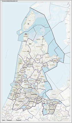
North Holland is a province (area with a local government) of the Netherlands. It is in the northwest. The capital is called Haarlem. Other cities in the province are Amsterdam, Hilversum, Alkmaar, Zaandam, and Hoorn. About 2,888,000 people are living in North Holland (2021).

