Back Santa Ana, Kalifornië Afrikaans Sanctanne, Californie ANG سانتا آنا (كاليفورنيا) Arabic سانتا آنا (كاليفورنيا) ARZ Santa-Ana (Kaliforniya) Azerbaijani سانتا آنا، کالیفورنیا AZB Санта-Ана (Каліфорнія) Byelorussian Санта-Ана (Каліфорнія) BE-X-OLD Санта Ана Bulgarian Santa Ana (Califòrnia) Catalan
Santa Ana, California | |
|---|---|
|
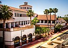
Top: Santora Building (left) and Santa Ana Regional Transportation Center (right); middle: Santa Ana City Hall (left), West Coast Theatre (center), and high rises (right); bottom: Bowers Museum (left) and Old Santa Ana Courthouse. | |
| Motto: Education First | |
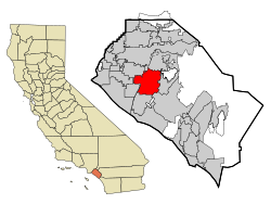
 Location of Santa Ana within Orange County, California | |
Location in the Los Angeles Metropolitan Area Location in California | |
| Coordinates: 33°44′27″N 117°52′53″W / 33.74083°N 117.88139°W | |
| Country | United States |
| State | California |
| County | Orange |
| Founded | 1869[1] |
| Incorporated | June 1, 1886[2] |
| Named for | Saint Anne |
| Area | |
| • Total | 27.37 sq mi (70.89 km2) |
| • Land | 27.34 sq mi (70.81 km2) |
| • Water | 0.03 sq mi (0.08 km2) 0.90% |
| Elevation | 115 ft (35 m) |
| Population | |
| • Total | 310,227 |
| • Rank | 2nd in Orange County 13th in California 64th in the United States |
| • Density | 11,000/sq mi (4,400/km2) |
| Demonyms |
|
| Time zone | UTC−8 (Pacific) |
| • Summer (DST) | UTC−7 (PDT) |
| ZIP Codes[6] | 92701–92708, 92711, 92712, 92728, 92735, 92799 |
| Area code | 657/714, 949 |
| FIPS code | 06-69000 |
| GNIS feature IDs | 1652790,[4]2411814 |
| Website | santa-ana.org |
Santa Ana is a city in California. It is the county seat and has the second most people of any city in Orange County. It is the 53rd biggest city in the United States. In 2020, 310,227 people lived in Santa Ana,[5] The city was founded in 1869. It is in Southern California on the Santa Ana River, 10 miles (16 km) away from the ocean. Santa Ana has the 2nd most dense population of mid-size US cities.[7]
The Santa Ana Freeway (Interstate 5) goes through the city. It also has the same name as the Santa Ana Mountains and the Santa Ana winds that cause fires in Southern California.[8]
Santa Ana is part of the Greater Los Angeles Area.
- ↑ "City of Santa Ana Vitals & Statistics" (PDF). City of Santa Ana. Archived from the original (PDF) on March 4, 2016. Retrieved February 6, 2015.
- ↑ "California Cities by Incorporation Date". California Association of Local Agency Formation Commissions. Archived from the original (Word) on February 21, 2013. Retrieved August 25, 2014.
- ↑ "2019 U.S. Gazetteer Files". United States Census Bureau. Retrieved July 1, 2020.
- ↑ 4.0 4.1 "Santa Ana". Geographic Names Information System. United States Geological Survey. Retrieved October 12, 2014.
- ↑ 5.0 5.1 "Quick Facts: Santa Ana, CA". United States Census Bureau.
- ↑ "ZIP Code(tm) Lookup". United States Postal Service. Retrieved November 12, 2014.
- ↑ "The most (and least) densely populated cities in America". Buffalo News. January 28, 2021. Retrieved August 27, 2023.
- ↑ "The Santa Ana Winds". people.atmos.ucla.edu.


