Back والنوت (كاليفورنيا) Arabic والنوت (كاليفورنيا) ARZ والنات، کالیفورنیا AZB Уолнът (град, Калифорния) Bulgarian Walnut (Califòrnia) Catalan Волнат (Калифорни) CE Walnut (lungsod sa Tinipong Bansa, California) CEB Walnut (Kalifornien) German Walnut, California English Walnut (Kalifornio) Esperanto
Walnut, California | |
|---|---|
 View of Mt. San Antonio College and surrounding area | |
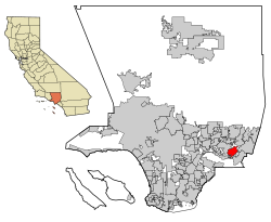
 Location of Walnut in Los Angeles County, California | |
| Coordinates: 34°2′N 117°52′W / 34.033°N 117.867°W | |
| Country | United States |
| State | California |
| County | Los Angeles |
| Incorporated (city) | January 19, 1959[1] |
| Named for | Rancho Los Nogales (English: Ranch of the Walnut Trees) |
| Area | |
| • Total | 9.00 sq mi (23.30 km2) |
| • Land | 8.99 sq mi (23.29 km2) |
| • Water | 0.00 sq mi (0.01 km2) 0.04% |
| Elevation | 561 ft (171 m) |
| Population | |
| • Total | 28,430 |
| • Density | 3,200/sq mi (1,200/km2) |
| Time zone | UTC-8 (PST) |
| • Summer (DST) | UTC-7 (PDT) |
| ZIP Codes | 91788, 91789, 91795[5] |
| Area code(s) | 909, 626 |
| FIPS code | 06-83332 |
| GNIS feature IDs | 1652808, 2412173 |
| Website | www |
Walnut is a city in Los Angeles County in the U.S. state of California.[6] During the 2020 census, the city had a population of 28,430.[4]
- ↑ "California Cities by Incorporation Date". California Association of Local Agency Formation Commissions. Archived from the original (Word) on November 3, 2014. Retrieved August 25, 2014.
- ↑ "2019 U.S. Gazetteer Files". United States Census Bureau. Retrieved July 1, 2020.
- ↑ "Walnut". Geographic Names Information System. United States Geological Survey. Retrieved February 23, 2015.
- ↑ 4.0 4.1 "QuickFacts: Walnut city, California". United States Census Bureau. Retrieved August 28, 2023.
- ↑ "USPS - ZIP Code Lookup - Find a ZIP+ 4 Code By City Results". Retrieved January 18, 2007.
- ↑ "About the City of Walnut". Archived from the original on June 5, 2016. Retrieved March 10, 2015.
