This article needs additional citations for verification. (September 2022) |
Moeraki | |
|---|---|
Village | |
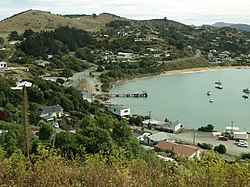
 View from Moeraki Esplanade Reserve in 2009 | |
 | |
| Coordinates: 45°21′43″S 170°50′28″E / 45.362°S 170.841°E | |
| Country | New Zealand |
| Region | Otago |
| Territorial authority | Waitaki District |
| Ward | Waihemo Ward |
| Community | Waihemo Community |
| Electorates |
|
| Government | |
| • Territorial authority | Waitaki District Council |
| • Regional council | Otago Regional Council |
| • Mayor of Waitaki | Gary Kircher |
| • Waitaki MP | Miles Anderson |
| • Te Tai Tonga MP | Tākuta Ferris |
| Area | |
| • Total | 8.53 km2 (3.29 sq mi) |
| Population (June 2023)[2] | |
| • Total | 120 |
| • Density | 14/km2 (36/sq mi) |
| Local iwi | Ngāi Tahu |
Moeraki is a small fishing village on the east coast of the South Island of New Zealand. It was once the location of a whaling station. In the 1870s, local interests believed it could become the main port for the north Otago area and a railway line, the Moeraki Branch, was built to the settlement and opened in 1877. However, the port could not compete with Oamaru and the lack of traffic as well as stability problems caused by difficult terrain led to the closure of the railway in 1879 after only two years' operation.
The village is best known for the nearby Moeraki Boulders.
- ^ Cite error: The named reference
Areawas invoked but never defined (see the help page). - ^ "Subnational population estimates (RC, SA2), by age and sex, at 30 June 1996-2023 (2023 boundaries)". Statistics New Zealand. Retrieved 25 October 2023. (regional councils); "Subnational population estimates (TA, SA2), by age and sex, at 30 June 1996-2023 (2023 boundaries)". Statistics New Zealand. Retrieved 25 October 2023. (territorial authorities); "Subnational population estimates (urban rural), by age and sex, at 30 June 1996-2023 (2023 boundaries)". Statistics New Zealand. Retrieved 25 October 2023. (urban areas)
